cloud_offOffline-Ready Navigation

Navigate Anywhere - No Cell Service Required

Download maps, charts, and supported layers before the trip so GPS navigation, routes, and waypoints stay with you offshore

Offline maps working without cell service

Why Offline Capability Matters

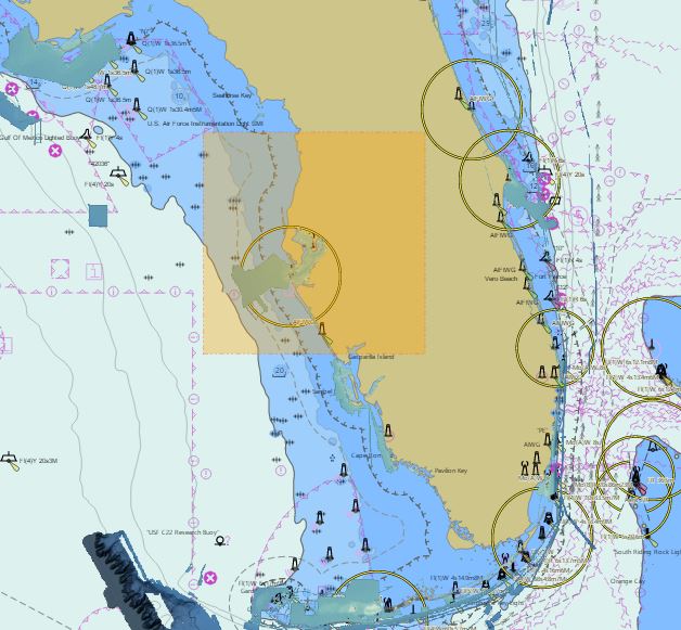
When you're 50 miles offshore targeting Grouper, cell service is non-existent. Most fishing apps become useless the moment you lose signal - leaving you blind without charts, waypoints, or navigation. That's dangerous and frustrating.

Fish Fathom was built for offshore and coastal anglers who need dependable navigation when coverage drops. With downloaded maps, charts, and supported layers, the app keeps GPS navigation, saved routes, and saved waypoints available offline.

Download what you need before leaving the dock, then run the trip without relying on a weak signal. Captain Brad AI and other live recommendation features still require an internet connection, but your downloaded navigation tools stay available on the water.

How to Download Maps for Offline Use

1

Select Your Region

Pan and zoom to the area where you'll be fishing, then choose the section of coast or offshore water you want available offline.

2

Choose Map Layers

Select the maps and supported layers you want on the device, including charts and relief shading. More detail uses more storage.

3

Download & Go

Download before the trip and you're ready to navigate with GPS, routes, and waypoints even when service drops.

What Works Offline

map

NOAA ENC Charts

Official electronic navigation charts with depth contours, navigation aids, and hazards - fully offline.

terrain

HD Relief Shading

High-definition underwater terrain visualization shows bottom structure without any internet connection.

location_on

Waypoints & Routes

Create, edit, and navigate saved waypoints and routes offline once the area is downloaded.

explore

GPS Navigation

Turn-by-turn navigation, course tracking, and distance monitoring - all offline using device GPS only.

public

Unlimited Regions

Save the regions you need for upcoming trips so your core navigation workflow stays available beyond cell range.

bolt

Hyper Performance

Downloaded maps render quickly without waiting on a weak connection or stalled tile requests.

Storage Requirements

Small Region (10 sq mi)

Approximately 50-100 MB

Example: Local reef area, nearshore fishing grounds

Medium Region (100 sq mi)

Approximately 500 MB - 1 GB

Example: Entire bay system, offshore ledge area

Large Region (1,000 sq mi)

Approximately 5-10 GB

Example: Entire coastline section, major fishing region

Tip: Download only the specific areas you fish to save storage space. You can always download additional regions later when connected to WiFi.

Offline Coverage Area

  • US Coastal Waters: East Coast, West Coast, Gulf of America - complete NOAA ENC coverage
  • Hawaii: All Hawaiian islands with NOAA charts and relief shading
  • Great Lakes: Superior, Michigan, Huron, Erie, Ontario - full navigation charts
  • Alaska: Comprehensive coverage of Alaskan waters and fishing grounds
  • Offshore: Deep water charts for offshore fishing - no more worrying about cell service

Benefits of Offline Navigation

  • Fish Anywhere: No cell service? No problem. Navigate confidently 100 miles offshore.
  • Battery Savings: No cellular radio means longer battery life when you're on the water all day.
  • Instant Performance: Maps load instantly without waiting for network requests or tile downloads.
  • Save Data Costs: No cellular data usage while navigating - perfect for limited data plans.
  • Peace of Mind: Know your navigation app will work no matter what - even if you lose your phone signal.
  • Clear Boundaries: Downloaded maps and navigation work offline, while Captain Brad AI and live recommendation features require internet.

Ready for Offline-Ready Fishing Navigation?

Download your maps before the trip, then navigate with confidence when service drops offshore.