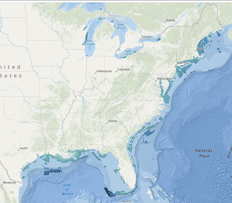
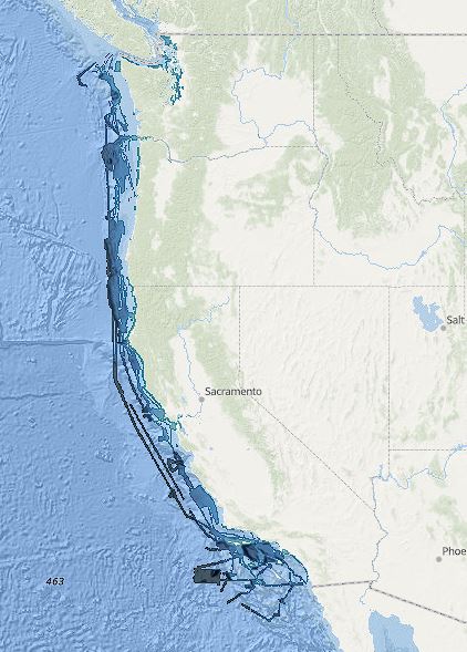
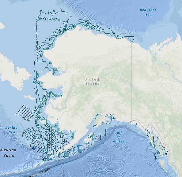
High Definition Relief Shading Maps

See underwater terrain in stunning detail - find ledges, drop-offs, and fish habitat like never before

High Definition Relief Shading showing underwater terrain structure

What is Relief Shading?

Relief shading (also called hillshading) is a visualization technique that uses light and shadow to reveal the three-dimensional structure of underwater terrain. Unlike flat nautical charts, relief shading makes depth contours, ledges, drop-offs, channels, and other bottom features instantly visible.

Fish Fathom uses high-definition relief shading data that far exceeds the grainy, pixelated maps found in competing apps. Our HD relief shading reveals bottom structure with incredible clarity, allowing you to identify productive fishing spots that others simply cannot see.

When you can clearly see the terrain, you can target fish habitat with precision. Rocky outcroppings, steep ledges, sand channels through reefs, and subtle depth changes all become obvious at a glance. This is the difference between fishing blind and fishing smart.

Why Relief Shading Matters

gps_fixed

Find Fish Habitat

Identify rocky structure, ledges, and drop-offs where fish congregate - the most productive fishing spots are immediately visible.

map

Better Visualization

Instantly understand underwater terrain at a glance instead of decoding confusing depth contour lines.

search

Discover New Spots

Find exclusive fishing spots that competitors' apps miss due to low-resolution, grainy relief shading.

anchor

Avoid Hazards

See shallow areas, reefs, and navigation hazards clearly to keep your boat safe while exploring new waters.

straighten

Target Depth Ranges

Quickly locate specific depth ranges for your target species - find the 80-120 ft ledge without guessing.

lightbulb

Structure Types

Differentiate between pilings, rock piles, wrecks, and natural reef - target the right species with the right bait.

Technical Specifications

Resolution

High-definition relief shading at resolutions far exceeding industry standards. No pixelated, grainy images.

Coverage Area

US Coastal waters (East, West, Gulf), Hawaii, Great Lakes, and Alaska - comprehensive coverage nationwide.

Data Source

Official NOAA bathymetric survey data processed with advanced shading algorithms for maximum clarity.

Offline Access

Download relief shading layers for offline use - navigate anywhere without cell service.

Nationwide Coverage

East Coast Relief Shading Coverage

East Coast

West Coast Relief Shading Coverage

West Coast & Hawaii

Alaska Relief Shading Coverage

Alaska

Fish Fathom vs Competition

Fish Fathom

  • ✓ High-definition, crystal-clear relief shading
  • ✓ Bottom structure clearly visible
  • ✓ Find exclusive spots others miss
  • ✓ Identify ledges, drop-offs, channels
  • ✓ Works offline with downloaded maps

Competing Apps

  • ✗ Pixelated, grainy relief shading
  • ✗ Bottom structure hard to interpret
  • ✗ Miss productive fishing spots
  • ✗ Confusing depth contour lines
  • ✗ Limited or no offline capability

Ready to See the Bottom in HD?

Stop guessing at bottom structure. Start seeing it clearly.