BlueTopo relief
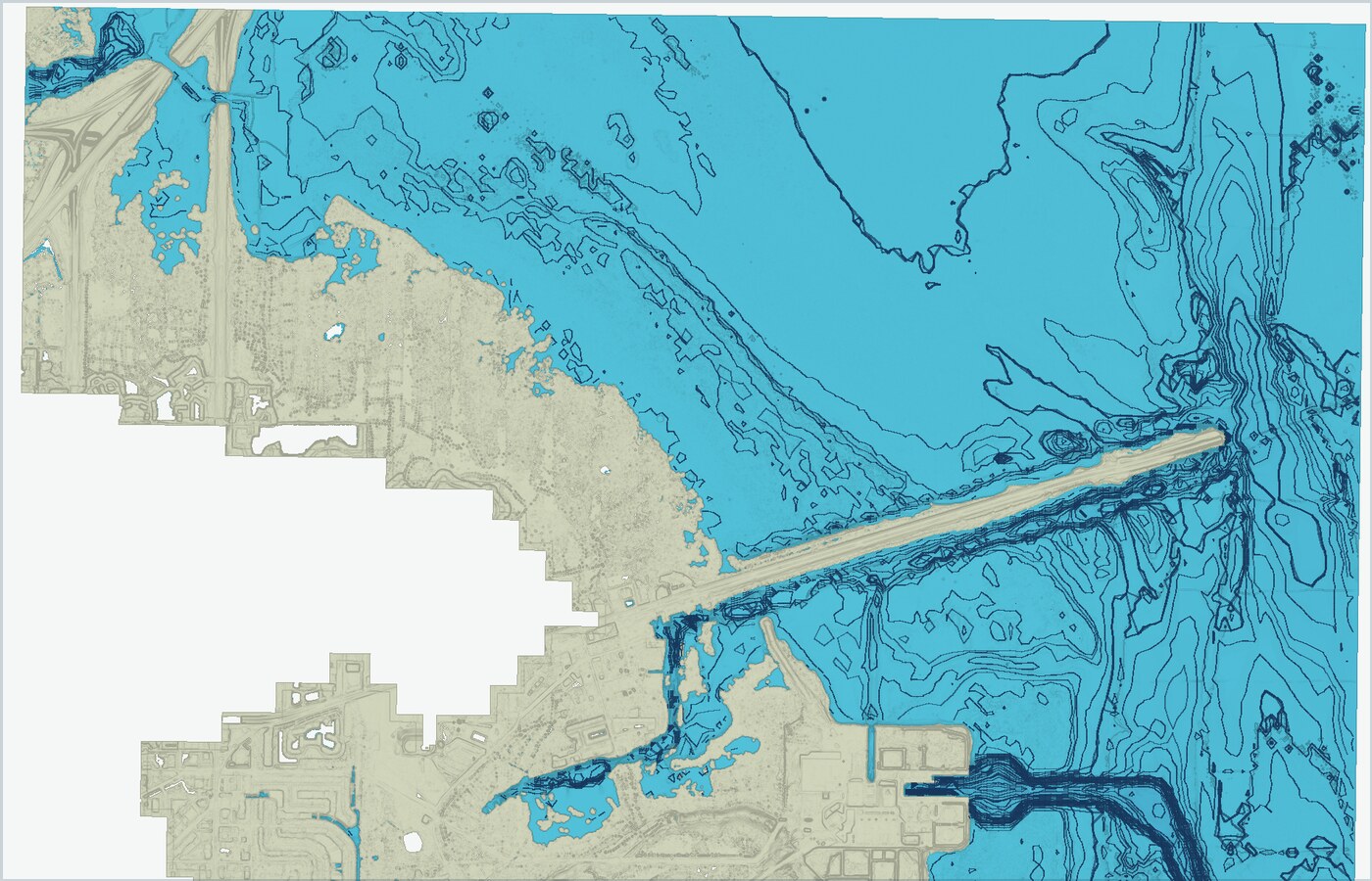
Download NOAA BlueTopo GeoTIFF-based relief where published coverage is available, then compare seafloor shape against your map plan.
Fish Fathom turns NOAA BlueTopo GeoTIFF coverage into downloadable relief, contour context, and a visible depth readout so Premium anglers can study bottom shape, save marks, and plan routes around structure.
Premium from $5.99/mo or $44.99/yr. Built for anglers comparing serious bathymetry tools.
BlueTopo is most useful when it connects to the rest of the trip plan: chart context, saved waypoints, routes, offline packages, and conditions.
Download NOAA BlueTopo GeoTIFF-based relief where published coverage is available, then compare seafloor shape against your map plan.
Keep a numeric depth readout visible while you pan so a ledge, channel, or shoal can be checked without leaving the map.
Use Fish Fathom contour overlays generated from BlueTopo depth packages to scan depth changes faster.
Gulf and East Coast areas are the first production focus because NOAA currently publishes the most BlueTopo GeoTIFF coverage there.
Fish Fathom only offers BlueTopo downloads where the NOAA tile scheme includes downloadable GeoTIFF products.
BlueTopo relief and contours are Premium map layers, with visible availability in the app so anglers can evaluate the upgrade.
BlueTopo layers are planning context and do not replace official navigation, weather checks, local knowledge, or required safety equipment.