

Real app screens
Screenshots show map layers, Captain Brad, catch history, and offline prep instead of generic fishing art.
Fish Fathom combines structure layers, offshore conditions, downloaded areas, waypoints, routes, and practical planning help for serious offshore anglers.
Premium from $5.99/mo or $44.99/yr. Built for serious offshore planning.
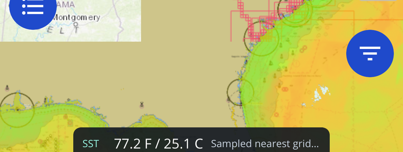
Offshore map traffic needs proof before it becomes an install. The store links keep screenshots, current reviews, and privacy details close to the map-layer claims on this page.
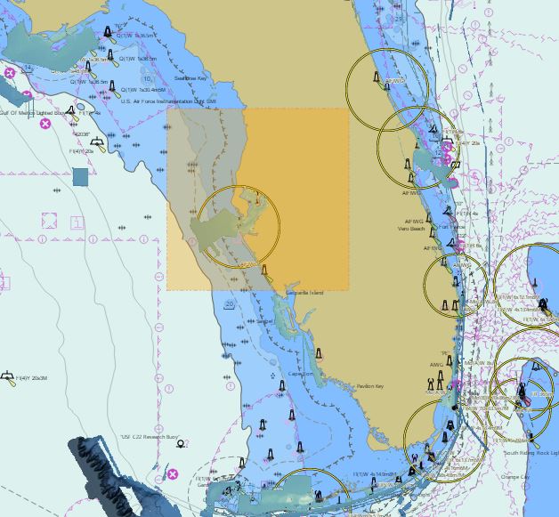
Screenshots show map layers, Captain Brad, catch history, and offline prep instead of generic fishing art.
App Store, Google Play, and Microsoft Store pages stay one click away for current screenshots, version details, privacy labels, and reviews.
Fish Fathom supports trip decisions and is not a substitute for required navigation, regulations, safety gear, or local judgment.
Fish Fathom is for anglers who want map context before committing time, fuel, and weather windows to an offshore run.
Compare recent NOAA-backed SST and water context with saved routes and marks.
Prepare important map areas before leaving service so your core plan stays visible offshore.
Use broad Standard Bathymetry, HD Bathymetry where supported, contour, and bottom-context layers to narrow where you investigate.
These answers are written for anglers comparing serious offshore planning tools and for search systems that need direct, visible page context.
Fish Fathom puts structure layers, offshore conditions, routes, waypoints, downloaded map areas, and Captain Brad planning help in one mobile workflow so anglers can compare a plan before spending fuel.
Best next step: pick the target area, compare structure and conditions, then save the route and map area.
No. Fish Fathom is a planning companion for map research, conditions, routes, waypoints, and private fishing context. Use required navigation equipment, current regulations, safety gear, and local judgment on the water.
Use it before and during planning, not as the only navigation or safety source.
Download supported map areas after you identify the target structure, route, and backup plan, and before leaving reliable service. Fresh connected layers and AI features can still require service.
Download once the plan is specific enough to run.
Offshore, coastal, and Great Lakes anglers planning around structure, SST, routes, and weather windows.
Casual browsing, social feeds, or trips where offshore map layers are not part of the decision.
Download offshore map areas, save routes, and organize waypoints before the run starts.
Structure, conditions, and offline readiness should reinforce each other instead of living on isolated feature pages.
Premium from $5.99/mo or $44.99/yr. Fish Fathom is a planning companion, not a replacement for required navigation or safety gear.