Start with evidence
Compare bathymetry, relief, public structure context, private history, and recent conditions before saving the first mark.
A useful offshore plan should turn map research into a concrete run: target structure, weather-window review, saved waypoints, route options, offline prep, and a backup decision if conditions change.
Built for captains, clubs, shops, and anglers who need a shareable pre-run checklist without promising catches or replacing official safety tools.
Compare bathymetry, relief, public structure context, private history, and recent conditions before saving the first mark.
The plan should say where to start, when to leave, what to skip, and where to pivot if the first run no longer makes sense.
Fish Fathom supports planning. Regulations, navigation, safety gear, and final go/no-go decisions still require official sources and local judgment.
Use the checklist as a pre-trip planning worksheet, captain email, club handout, or content outline.
Name the target species or structure type, available daylight, crew comfort, fuel range, and the point where the trip should turn back.
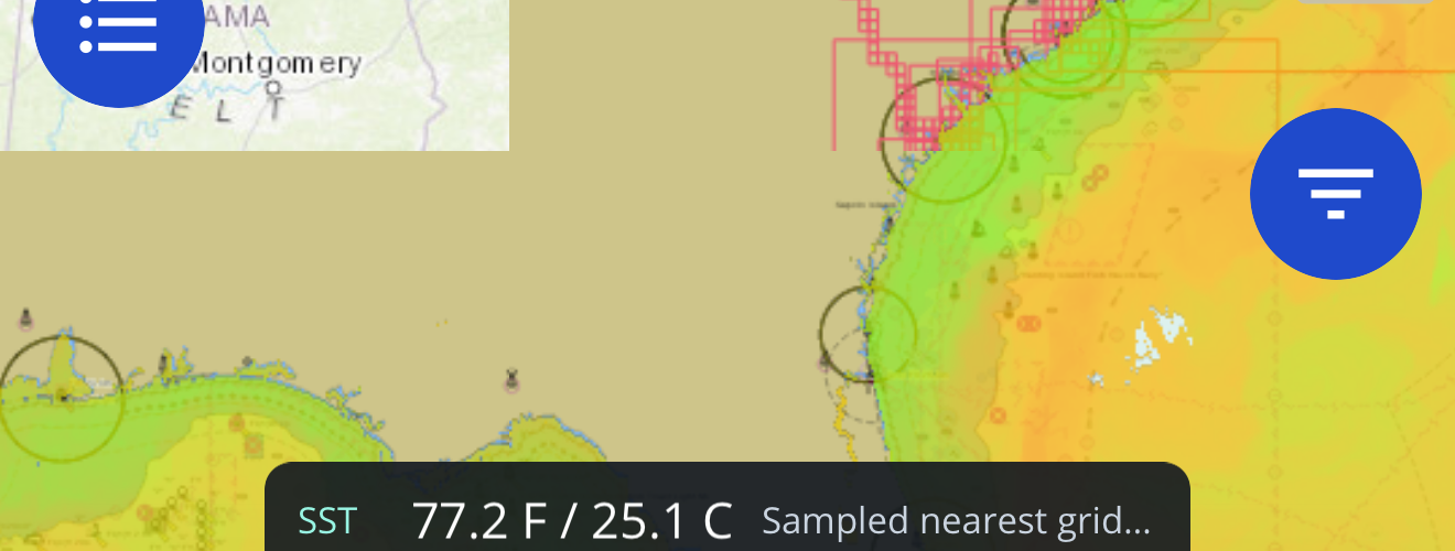
Use bathymetry, contours, relief, hard-bottom context, wrecks, ledges, channels, and known private marks to identify candidate areas.
Review wind, sea state, tide/current exposure, storms, sea-surface temperature context, and the expected return window.
Mark the first stop, secondary structure, safe staging areas, and a conservative fallback plan before leaving service.
Create a route for the primary plan and a shorter route for changing seas, crew fatigue, fuel burn, or closed access.
Download supported map areas, confirm the device has storage and battery, and keep required navigation tools onboard.
Use Captain Brad to pressure-test the plan with target species, structure, weather-window assumptions, private history, and backup options.
Document the weather, fuel, daylight, regulation, or crew-safety signal that will cancel or shorten the run.
The best checklist is specific enough to act on and simple enough to reuse.
Species, structure type, season, depth range, and why this plan is worth the fuel.
Bathymetry, relief, hard-bottom context, vessel history, saved marks, or survey clues that support the run.
Wind, seas, tide/current exposure, expected return timing, and the conservative cutoff.
Primary route, fallback route, downloaded map area, battery plan, and required navigation tools.
Current regulations, required gear, float plan, official forecasts, and communication plan.
What changed, what worked, which marks to keep, and what the next plan should test.
Most feature pages ask for attention. A checklist helps another site, captain, club, or shop answer a real pre-trip question.
Link the checklist when clients ask how you decide whether an offshore trip is worth running.
Use it as the outline for a structure, weather, and route-planning session.
Reference the checklist before showing how a plan changed after weather, bait, or structure review.