Hard-bottom review
Compare hard-bottom context, depth changes, low-relief edges, and nearby contours before choosing a scouting lane.
Fish Fathom helps Gulf anglers compare bottom structure, relief shading, hard-bottom context, private waypoints, routes, and downloaded map areas before choosing which red grouper plan deserves the run.
Premium connects structure research, offline prep, route planning, private marks, and Captain Brad prompts before you commit fuel and crew time.
Fish Fathom supports planning. Always verify current regulations, safety requirements, weather, and navigation decisions with official sources and onboard equipment. It does not guarantee catches.

Regional species pages are built for anglers comparing structure, water, saved history, and route decisions before fuel and crew time are committed.
Compare hard-bottom context, depth changes, low-relief edges, and nearby contours before choosing a scouting lane.
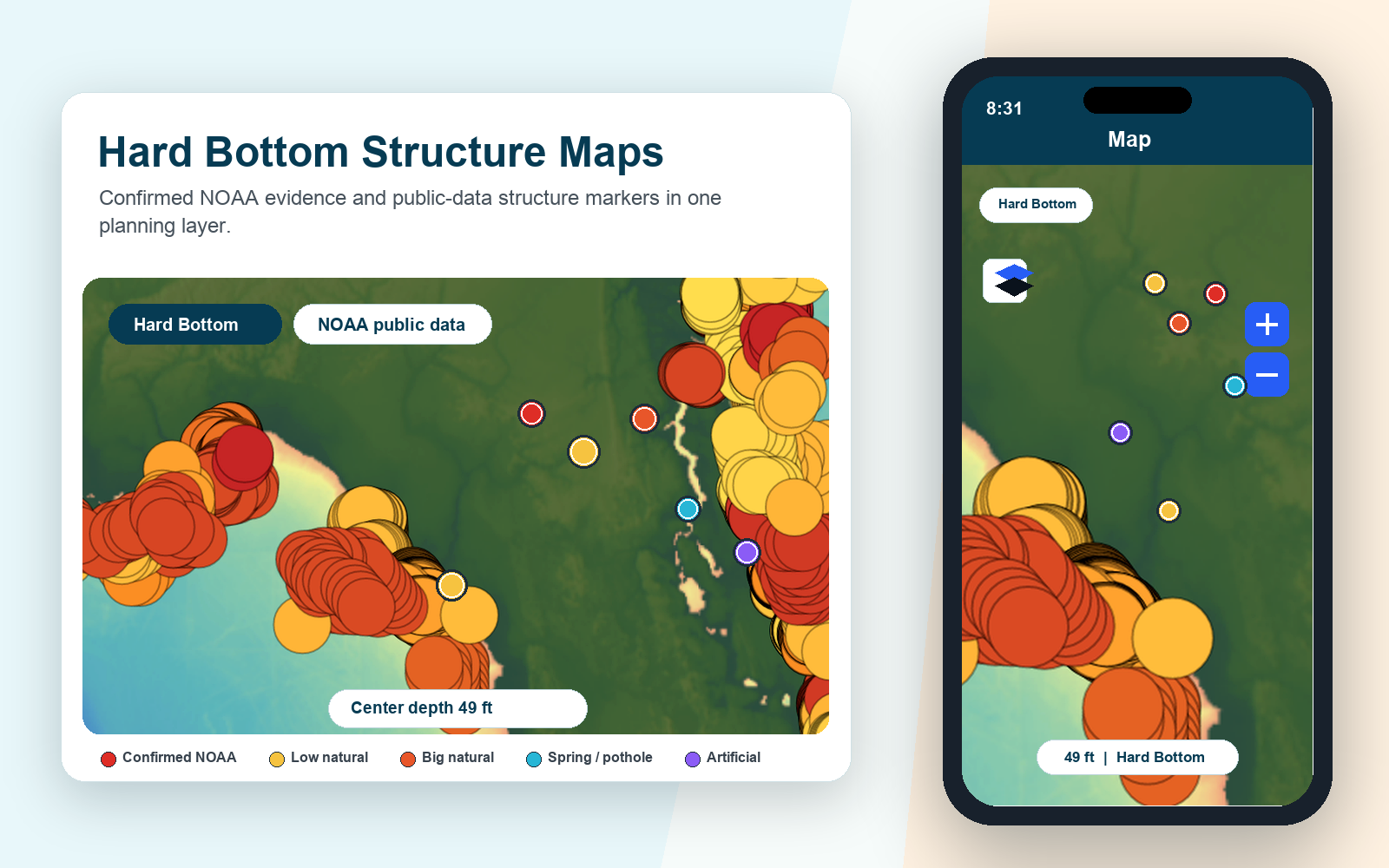
Use bathymetry and relief shading to separate broad bottom from specific edges, breaks, and subtle structure worth a second look.
Keep red grouper notes, catch logs, missed stops, bait notes, and route decisions private so the next plan starts from your own evidence.
Download important map areas and save route options before you leave reliable service on a Gulf run.
Red grouper planning often starts with bottom type, relief, ledges, and depth context. Fish Fathom keeps those signals near your private waypoints and route plan so you can compare several options before deciding where to spend the day.
Explore bottom hardnessStart with hard-bottom context, relief, contours, and nearby transitions that match the kind of structure you want to inspect.
Compare candidate zones by distance, depth, route shape, and how much supporting map context exists nearby.
Mark private stops, build a practical route, and download the map area before the run.
Review weather, sea state, crew limits, and current rules with official sources before making the go decision.
Captain Brad can help compare saved marks, diary notes, catch logs, map layers, and weather context so the plan is easier to explain and adjust. Treat its answer as planning support, not a legal, safety, or catch guarantee.
Fish Fathom keeps bottom context, bathymetry, relief shading, private waypoints, route planning, offline map prep, and Captain Brad prompts in the same workflow.
No. Fish Fathom is a planning tool for comparing map evidence and private history. It does not guarantee fish locations or replace current rules, forecasts, or local knowledge.
Start with bottom hardness, relief shading, depth color, contours, routes, saved waypoints, and weather-window context, then verify the plan with current conditions and official regulations.
Premium from $5.99/mo or $44.99/yr. Fish Fathom helps organize bottom research, private routes, offline map prep, and planning context before the offshore day starts.