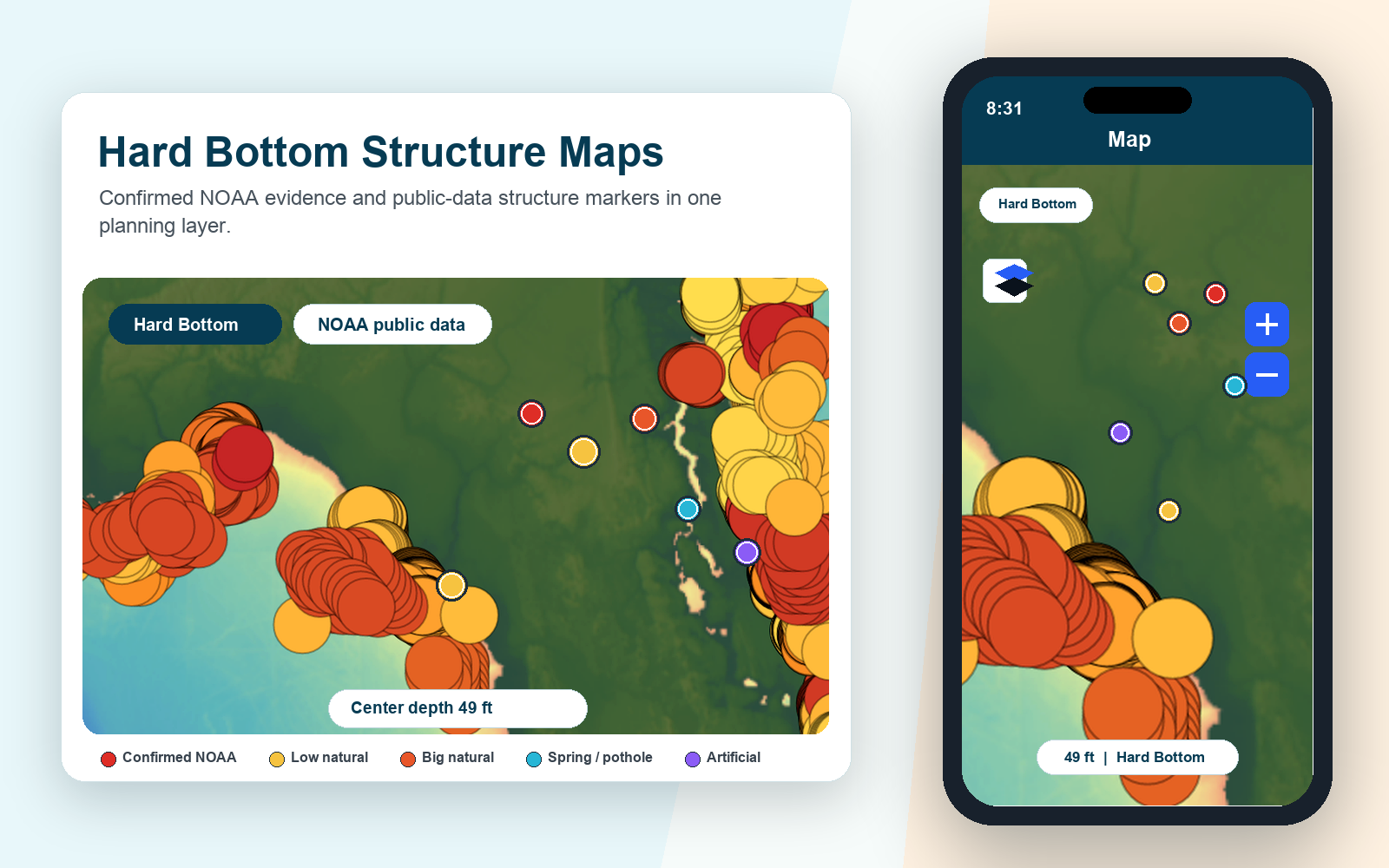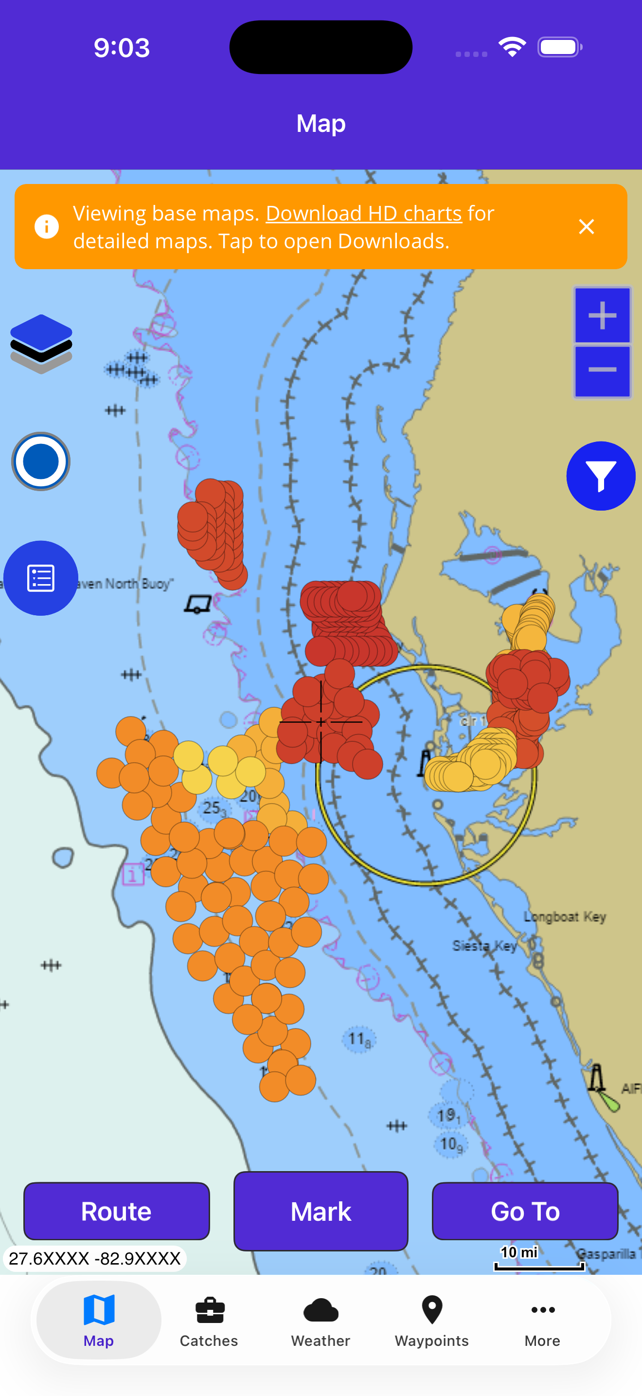
The Hard Bottom layer now combines confirmed NOAA NOS seabed points with additional Fish Fathom structure markers produced from NOAA public data. Instead of generic dots, the map uses structure-aware symbols and color families that make hard bottom, ledges, reef-like structure, potholes, and other seafloor texture easier to scan.
Confirmed NOAA points use stronger symbols. Additional NOAA-public-data markers use lighter symbols so they read as scouting context. Both remain controlled by the standard Hard Bottom layer control and opacity setting.