Keep context with the mark
A waypoint becomes more useful when it has timing, depth, structure, conditions, result, and why it matters next time.
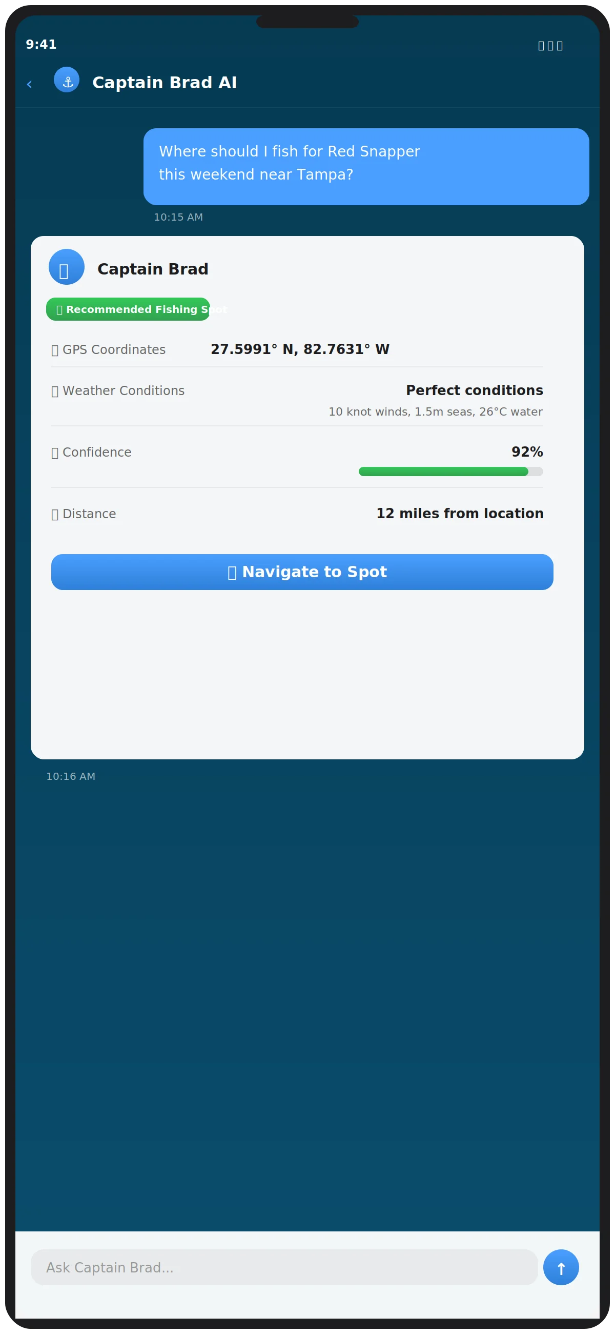
A useful spot system is more than a pile of coordinates. It connects waypoints, routes, catch details, diary notes, conditions, and selected sharing into private planning evidence.
Built for anglers, captains, and clubs who want better personal memory without broadcasting exact productive marks.
A waypoint becomes more useful when it has timing, depth, structure, conditions, result, and why it matters next time.
Share selected route or waypoint context when needed without turning every saved mark into public content.
Catch logs and diary notes help the next plan because they capture what happened, what changed, and what to avoid.
Use it as a captain workflow, club education piece, or personal spot-management routine.
Use a name that describes structure, purpose, or trip context instead of a vague number that loses meaning.
Record depth, relief, bottom type, ledge, wreck, edge, channel, bait, or current reason the mark matters.
Tie the spot to the route, fuel range, weather exposure, launch point, and backup plan.
Track what happened, what species showed, what changed, and whether the mark deserves another look.
Capture the planning lesson: bait, timing, pressure, weather-window read, or reason the plan should change.
Separate scout marks, proven structure, weather-dependent areas, backup stops, and private client-sensitive marks.
Use selected route, waypoint, or GPX workflows only when the person receiving context should have it.
Use Captain Brad to compare your private history with map layers and conditions when planning the next run.
These fields make a saved location easier to understand months later.
Scout mark, proven stop, backup option, client-sensitive mark, bait area, or route reference.
Map layer, structure clue, vessel history, catch log, diary note, or captain observation that supports the mark.
Season, tide/current, weather window, water temperature context, daylight, and pressure notes.
Caught, missed, skipped, unsafe, too crowded, wrong timing, or needs another look.
Private only, share with crew, share as route context, export GPX, or keep hidden from trip recap.
Revisit, delete, merge with nearby marks, add route, download map area, or ask Captain Brad.
Anglers understand the value of hard-won local knowledge. This guide gives partners a practical way to talk about privacy without attacking competitors.
Use it to explain how clients can learn planning without receiving every exact private mark.
Turn the system into a workshop on cleaning up old marks and improving future trip notes.
Link it from posts about avoiding public spot pressure and keeping private history useful.